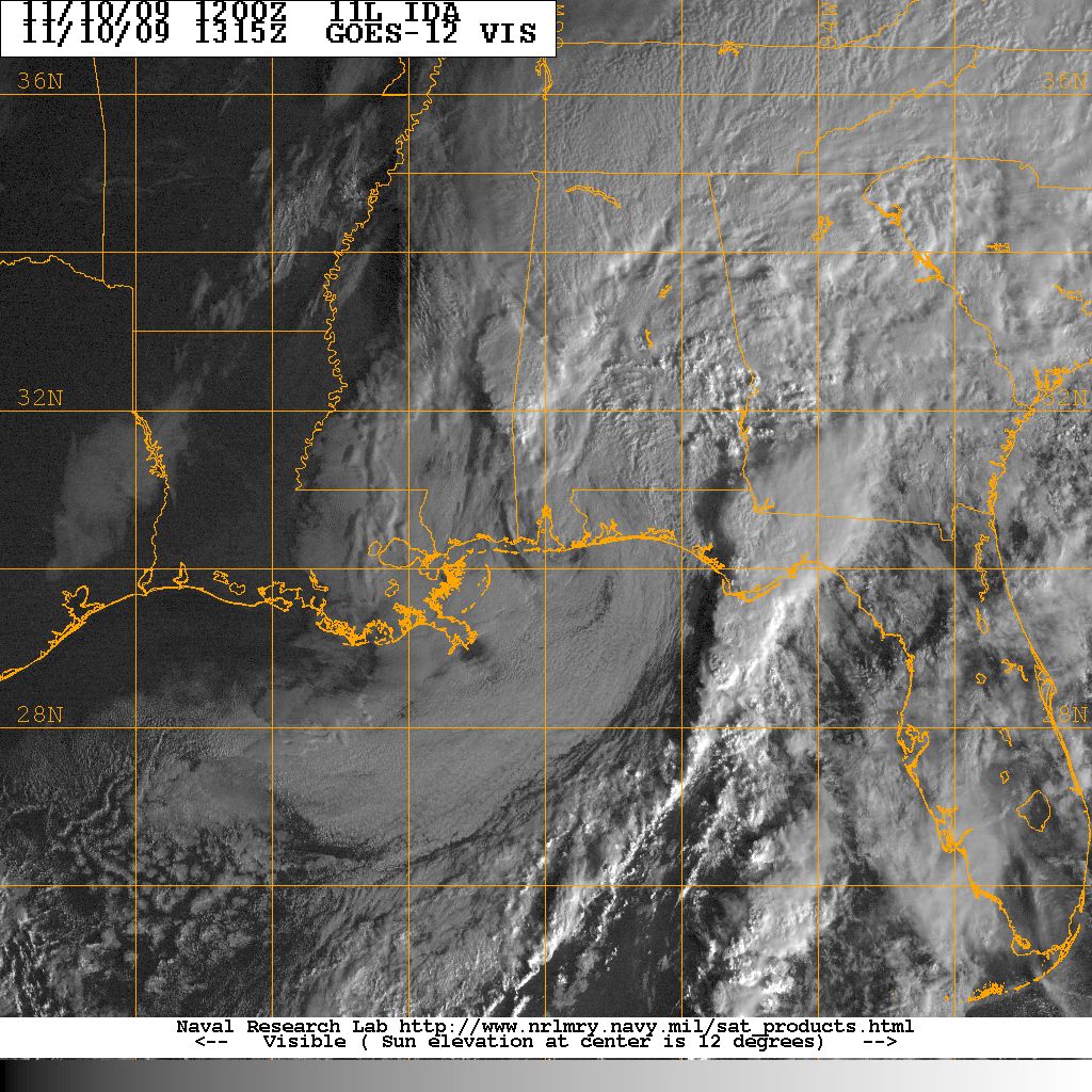

Visible satellite image of Tropical Storm Ida as the 35 knot storm made landfall near Mobile Bay Alabama on the morning of 10 November. Image courtesy of the Naval Research Laboratory, Monterey CA.
Ida initially formed off the coast of Nicaragua and became a minimal hurricane just before making landfall on the eastern Nicaraguan coast on 5 November. Ida weakened slightly as it tracked over land but intensifed as it emerged over the warm waters of the western Caribbean. Ida tracked through the Yucatan Channel and entered the Gulf of Mexico as a 85 knot hurricane. Upper level shear weakend Ida as the storm tracked across the central Gulf of Mexico. Ida made landfall near Mobile Alabama on 10 November. Ida came ashore as a 40 knot tropical storm and rapidly became an extratropical low over the Florida Panhandle
The remnants of Tropical Storm Ida produced heavy rainfall across South Carolina. No storm related damage was reported.
| City | Rainfall(inches) | City | Rainfall(inches) | |
|---|---|---|---|---|
| Allendale | Ridgeville | |||
| McClellanville | Givhans | |||
| Fort Moultrie | Charleston City | |||
| Charleston AFB | Beaufort | |||
| Loris | Crabtree Swamp | |||
| Gallivants Ferry | Mullins | |||
| North Myrtle Beach | Georgetown Airport | |||
| Dillon | Hemingway | |||
| Clarks Hill | Newberry | |||
| McCormick | Sandy Run | |||
| Little Mountain | Aiken | |||
| Saluda | Johnston | |||
| Walhalla | Table Rock | |||
| Clinton | Antreville | |||
| Laurens | Calhoun Falls | |||
| Greenwood | Greer |
| Location | Peak Winds |
|---|---|
| Anderson | |
| Charleston AFB | |
| Columbia Metro | |
| Florence | |
| Greenville-Donaldson | |
| Greenville-Spartanburg | |
| Hilton Head | |
| Myrtle Beach | |
| Rock Hill |
ACKNOWLEDGEMENTS:
Special thanks to the National Oceanic and Atmospheric Administration and its many divisions for the wealth of weather and climate data made available to prepare this report. Specific thanks to:
Additional thanks to the Naval Research Laboratory Monterey's Marine Meteorology Division for the well-cataloged library of satellite imagery used for this report.
