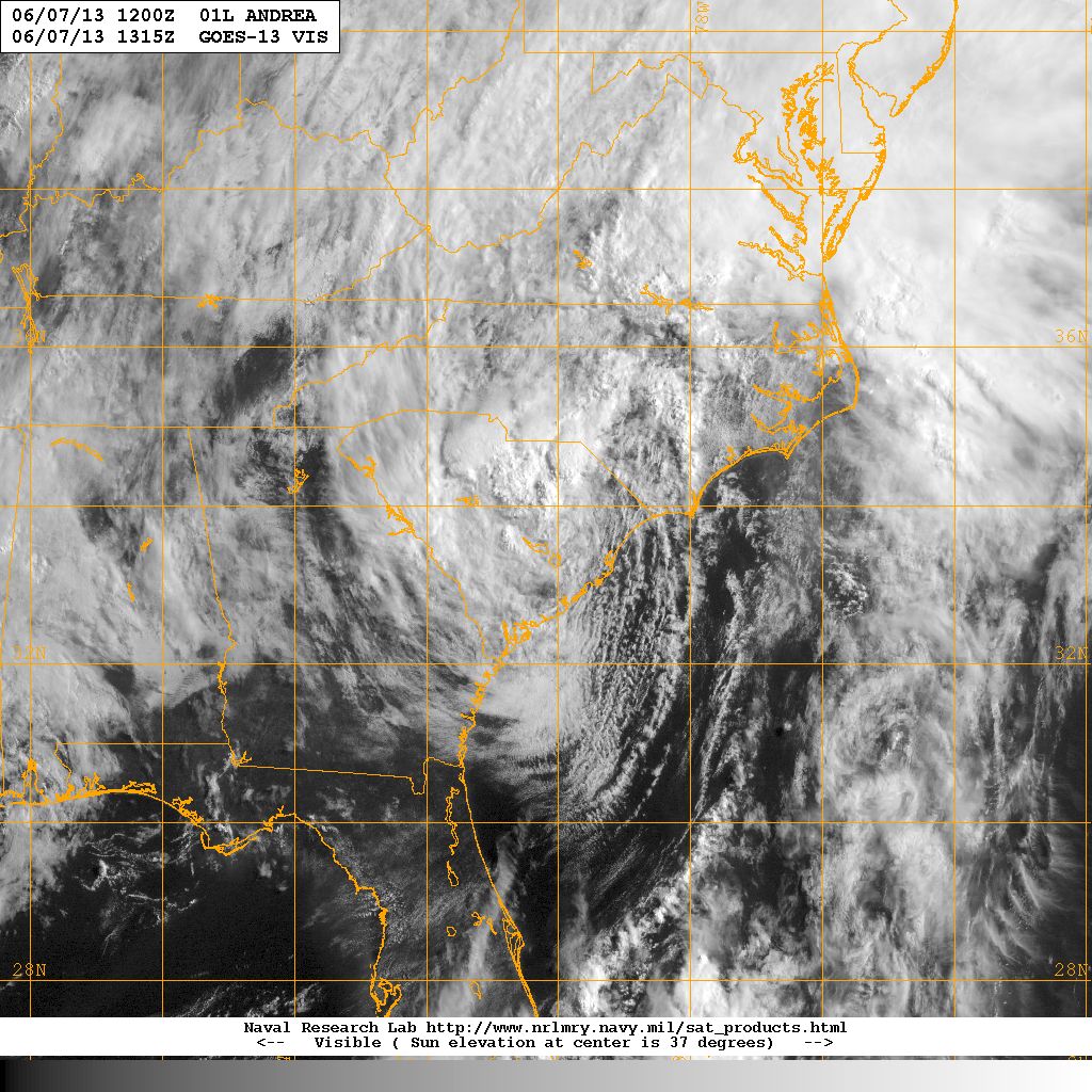


Visible satellite image of Tropical Storm Andrea (left) 06 June 2013 at Florida coast landfall. Tropical Storm Andrea (right) over South Carolina, 07 June 2013 . Image courtesy of the Naval Research Laboratory, Monterey CA.
Tropical Storm Andrea formed rapidly over the southeastern Gulf of Mexico on Wednesday 5 June. Andrea tracked north and made landfall near the Big Bend region of the Florida Panhandle. Maximum sustained winds just prior to landfall were estimated to be 63 mph. Andrea tracked across Florida and southeast Georgia, weakening rapidly, and the center of circulation entered South Carolina approximately 0330 on Friday, 7 June with a narrow eastern envelope of 46 mph sustained winds. Andrea rapidly swept across the State and up the eastern seaboard Friday afternoon, 7 June.
Tropical Storm Andrea produced only minimal coastal damage: minor flooding, downed trees and power lines, and minor beach erosion. A surfer offshore North Myrtle Beach went missing in heavy surf 8 June, and was not recovered.
| City: | Rainfall: | City: | Rainfall: | |
|---|---|---|---|---|
| Aiken | Beaufort MCAS | |||
| Charleston AFB | Charleston Downtown | |||
| Columbia Metro | Darlington Fire Dept. | |||
| Florence Airport | Huger 3 NNE | |||
| McColl | Murrells Inlet 1NNE | |||
| North Myrtle Beach | Orangeburg Airport | |||
| Shaw AFB | Summerville |
| Location | Peak Wind Gusts |
|---|---|
| Ravenel Bridge | |
| Springmaid Pier | |
| Sullivans Island | |
| North Myrtle Beach | |
| Kiawah Island | |
| Charleston AFB | |
| Georgetown | |
| Florence |
ACKNOWLEDGEMENTS:
Special thanks to the National Oceanic and Atmospheric Administration and its many divisions for the wealth of weather and climate data made available to prepare this report. Specific thanks to:
Additional thanks to the Naval Research Laboratory Monterey's Marine Meteorology Division for the well-cataloged library of satellite imagery used for this report.
