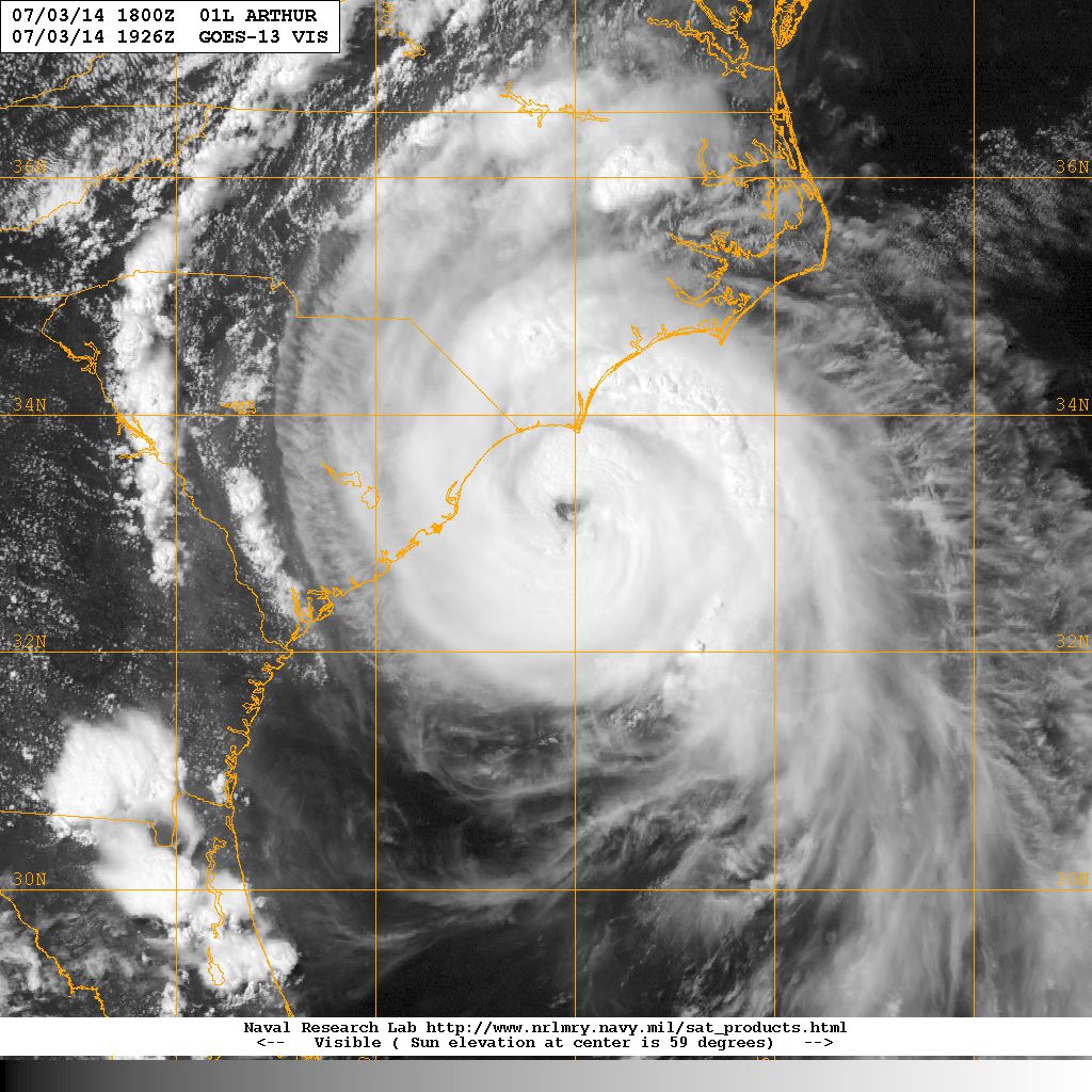

Visible satellite image of Hurricane Arthur 3 July 2014. Image courtesy of the Naval Research Laboratory, Monterey CA.
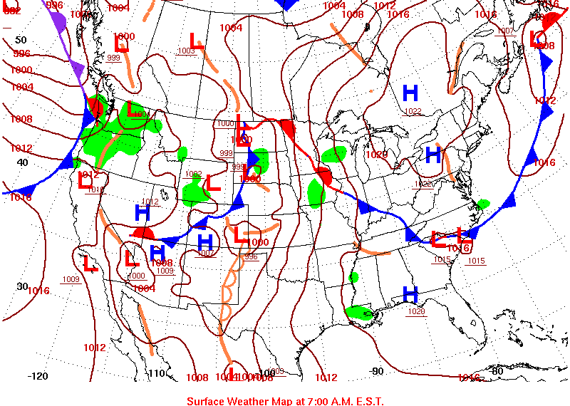
Hurricane Arthur originated from the low-level remnants of a frontal boundary that decayed over South Carolina 26-27 June (Figure 1.). This feature drifted off the South Carolina coast and tracked southwards along the Florida coast before becoming Tropical Depression One at 11 PM, 30 June with an initial intensity of 30 knots. TD One remained quasi-stationary over anomalously warm waters and decreasing wind shear for 24 hours

Figure 1. US surface weather analysis 27 June 2014. Image source: NOAA.
The National Hurricane Center upgraded TD One to Tropical Storm Arthur with the 11 AM 1 July advisory. Arthur began slowly tracking north later that day and continued on northerly track for the next 48 hours. The storm slowly intensified until 3 July when the National Hurricane center upgraded Arthur to a hurricane, 98 miles southeast of Charleston. Hurricane Arthur then turned northeast, accelerated and strengthened to 100 mph hurricane before making landfall over North Carolina's Shackleford Banks at 11:15 PM, 3 July. At landfall the automated NOAA observing station on Cape Lookout recorded 77 mph sustained winds with gusts to 101 mph. The National Hurricane Center's peak intensity for Hurricane Arthur was 100 mph maximunm sustained winds with a minimu central pressure of 973 mb.
Prior to passing the South Carolina coast, the National Hurricane Center issued a tropical storm watch for the beaches from the south Santee river to the North Carolina border. The watch was upgraded briefly to a Tropical Storm Warning as Hurricane Arthur passed directly offshore Myrtle Beach.
| City: | Rainfall: | City: | Rainfall: | |
|---|---|---|---|---|
| Barnwell | Charlestown AFB | |||
| Conway | Florence | |||
| Georgetown | Hilton Head | |||
| Moncks Corner | Mount Pleasant | |||
| North Myrtle Beach | Orangeburg |
| Location | Sustained Wind/Gust |
|---|---|
| Beaufort MCAS | |
| Charleston AFB | |
| Georgetown | |
| North Myrtle Beach | |
| Springmaid Pier |
ACKNOWLEDGEMENTS:
Special thanks to the National Oceanic and Atmospheric Administration and its many divisions for the wealth of weather and climate data made available to prepare this report. Specific thanks to:
Additional thanks to the Naval Research Laboratory Monterey's Marine Meteorology Division for the well-cataloged library of satellite imagery used for this report.
