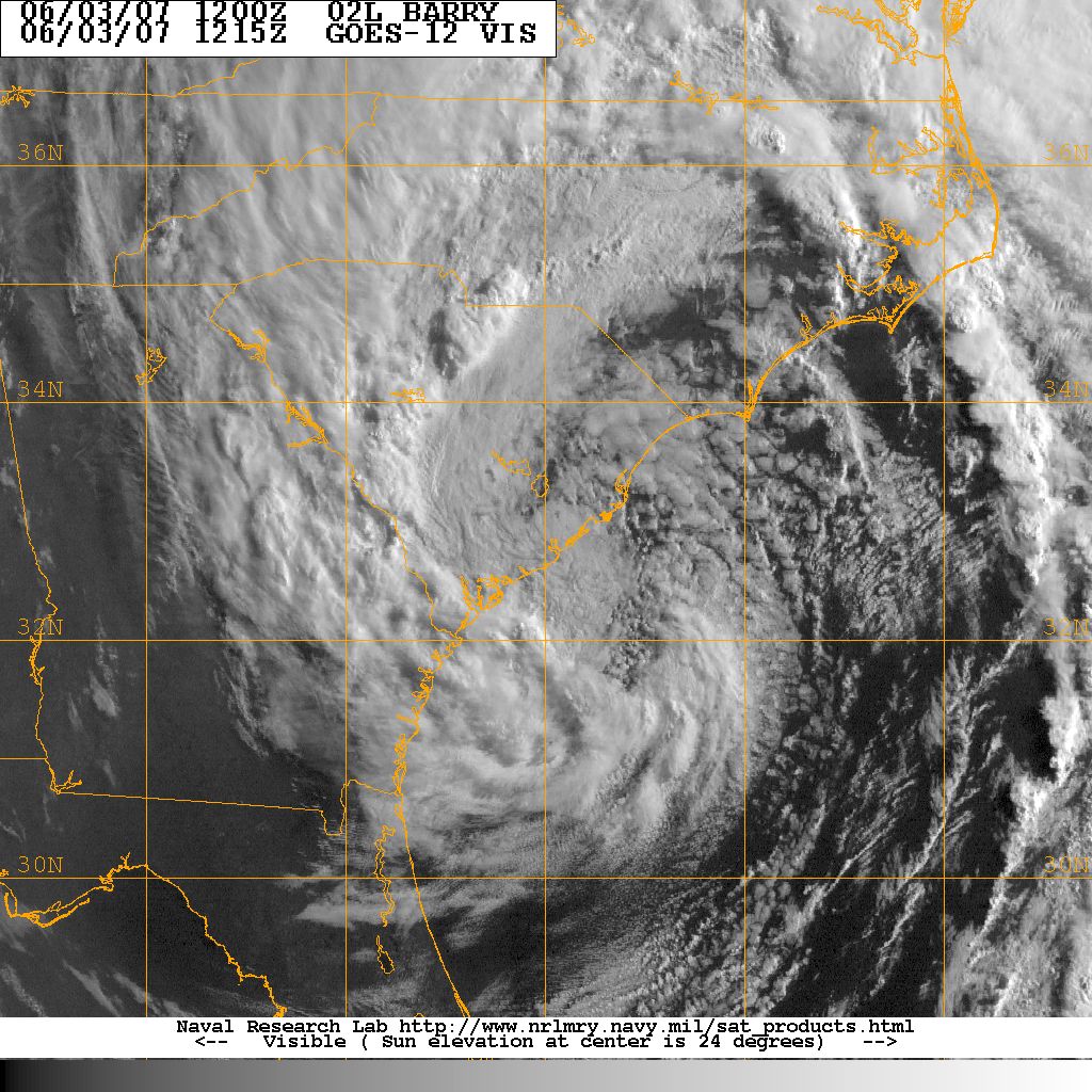

Visible satellite picture of the remnants of Tropical Storm Barry
Tropical Storm Barry formed south of Mexico's Yucatan Peninsula 1 June and tracked across the Gulf of Mexico making landfall on the west coast of Florida near Tampa on 2 June as a tropical depression. TD Barry became an extratropical low as it passed over Florida and lost all tropical characteristics by the time it reached eastern Georgia. The extratropical low moved offshore 3 June and tracked northeast up the US East coast.
The remants of TS Barry produced heavy rains across South Carolina. There were no coastal evacuations ordered. The highest reported wind gust was 51 mph recorded at Edisto Beach. Only minor storm related damage and minor beach erosion was reported. The South Carolina Emergency Management Division's Emergency Operation's Center was not activated. The remants of Barry did provide widespread beneficial rain to South Carolina just prior to the severe 2007-2008 drought.
Coastal:
Charleston		2.56
Edisto Island		1.80
Georgetown		2.07
Myrtle Beach		2.00
Sullivans Island	2.14
Yemassee		2.29

Midlands
Columbia Metro		1.25
Florence Regional	1.43
Sumter			0.95
Winnsboro		1.42

Upstate:
Anderson County		0.53
Chesterfield		1.03
Greenville/Spartanburg	0.24
ACKNOWLEDGEMENTS:
Special thanks to the National Oceanic and Atmospheric Administration and its many divisions for the wealth of weather and climate data made available to prepare this report. Specific thanks to:
Additional thanks to the Naval Research Laboratory Monterey's Marine Meteorology Division for the well-cataloged library of satellite imagery used for this report.
