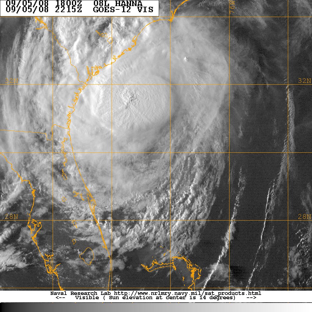

Visible satellite picture of Tropical Storm Hanna, 5 September
Tropical Storm Hanna caused only minimal damage to the South Carolina coast, as it scraped by offshore on September 5. The heaviest rains occurred in Charleston, Horry , and Marion Counties. Several streets in downtown Charleston were flooded temporarily. Only minor beach erosion was reported along the South Carolina coast due to the offshore winds from Hanna.
The South Carolina Emergency Management Division activated the Emergency Operations Center on September 3 when the National Hurricane Center began forecasting Tropical Storm Hanna to make landfall on the South Carolina coast. The Emergency Operations Center remained staffed until September 6. There were no mandatory evacuations. The Governor issued a voluntary evacuation order September 4 for Georgetown and Horry County coastal areas. Several emergency shelters were opened when Hanna threatened to make landfall August 31.
| Location | Rainfall | Location | Rainfall | |
|---|---|---|---|---|
| Marion | Galivants Ferry | |||
| Mullins | Dillon | |||
| Crabtree Swamp | McColl | |||
| Florence | Myrtle Beach | |||
| North Myrtle Beach | Georgetown | |||
| McClellanville | Mount Pleasant NNE | |||
| Summerville NW | Charleston (KCHS) | |||
| Witherbee | Folly Beach | |||
| Bennetts Point | N Beaufort | |||
| Beaufort MCAS |
| Location | Maximum Sustained |
Peak Gust | |
|---|---|---|---|
| North Myrtle Beach | |||
| Myrtle Beach | |||
| Florence | | ||
| Charleston AFB | |||
| Charlestown Downtown | |||
| Beaufort MCAS | |||
| Hilton Head |
ACKNOWLEDGEMENTS:
Special thanks to the National Oceanic and Atmospheric Administration and its many divisions for the wealth of weather and climate data made available to prepare this report. Specific thanks to:
Additional thanks to the Naval Research Laboratory Monterey's Marine Meteorology Division for the well-cataloged library of satellite imagery used for this report.
