Overview
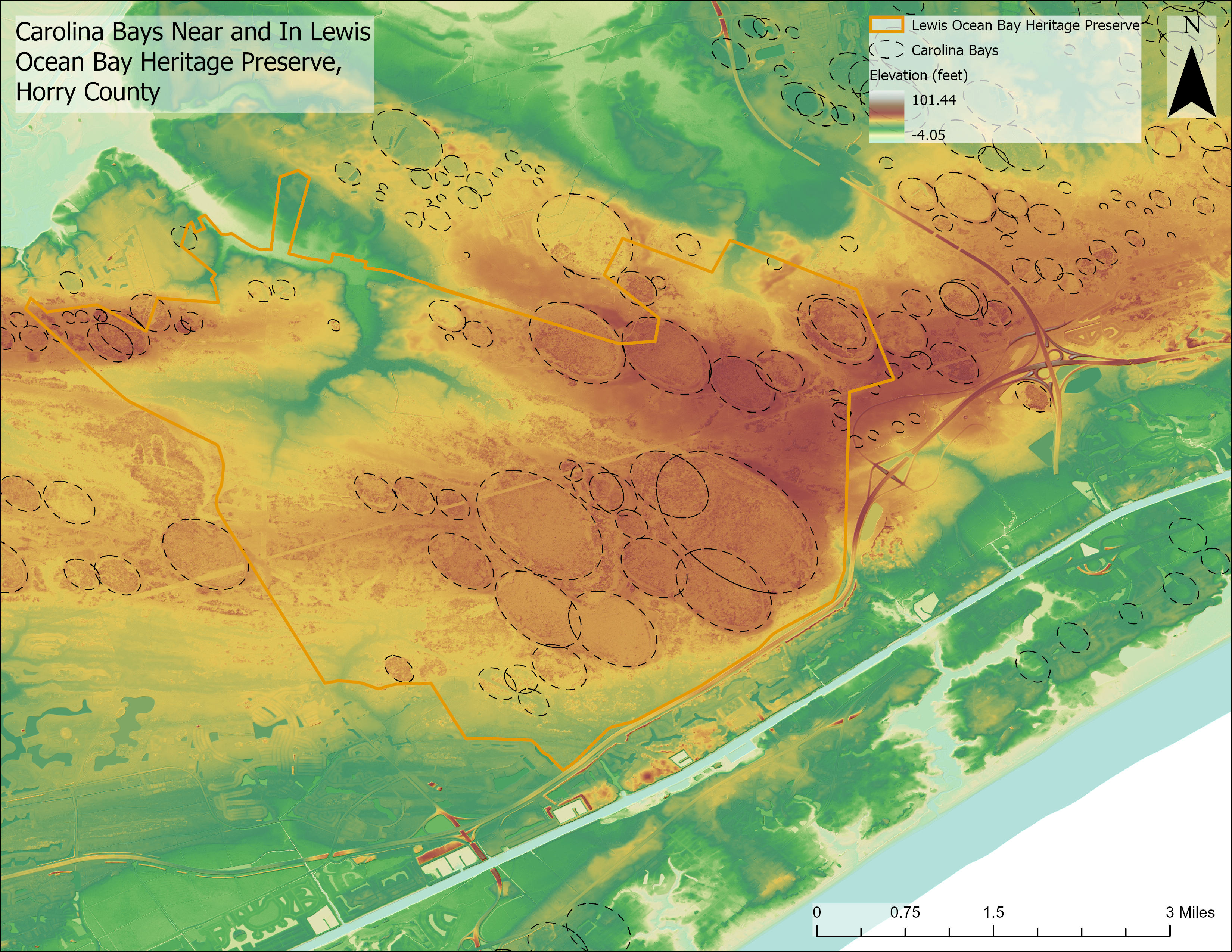
Carolina bays are shallow, elliptical depressions found in the unconsolidated sediments throughout the Atlantic Coastal Plain from Florida to New Jersey (Glenn 1895). State geologist Michaael Tuomey (1848) was the first to note the distinctive shape of these geomorphic features. They are sometimes called pocosins (Savage, 1982), an Indian word for swamp on a hill. Bays can range from thirty feet to almost three miles in diameter, are elongated in a northwest-southeast direction with long axes perpendicular to shoreline, and may have sand berms along their southeast and northeast edges (Hayes and Michel 2008; Glenn 1895). Many bays have been modified by human activity such as the conversion to agricultural uses, commercial or residential development, and ponds. Relatively undisturbed bays collect rainwater and support plant communities associated with wetlands including: vegetated lakes, grass-sedge prairies, and cypress-gum swamps (Bennet and Nelson 1991). Prescribed burning and historic fires have allowed fire tolerant plants like longleaf pine, pond pine, fly traps, pitcher-plants, and orchids to thrive (Hayes and Michel 2008). Estimates on the number of Carolina bays in South Carlina range from 4,000 (Bennet and Nelson 1991) to 200,000 (Prouty 1952). Carolina bays were approved as a protection priority of the South Carolina Heritage Trust Program in 1983.
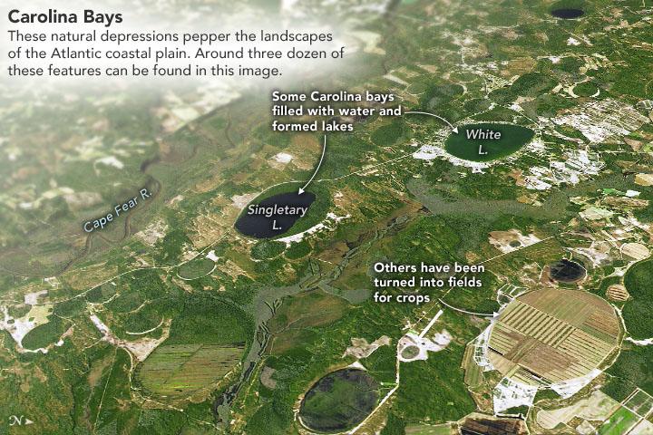
Figure 1. The image above (created by Joshua Stevens) was taken from a NASA Earth Observatory post written by Adam Voiland (2021). It features Carolina bays near Bladen Lakes State Forest, North Carolina.
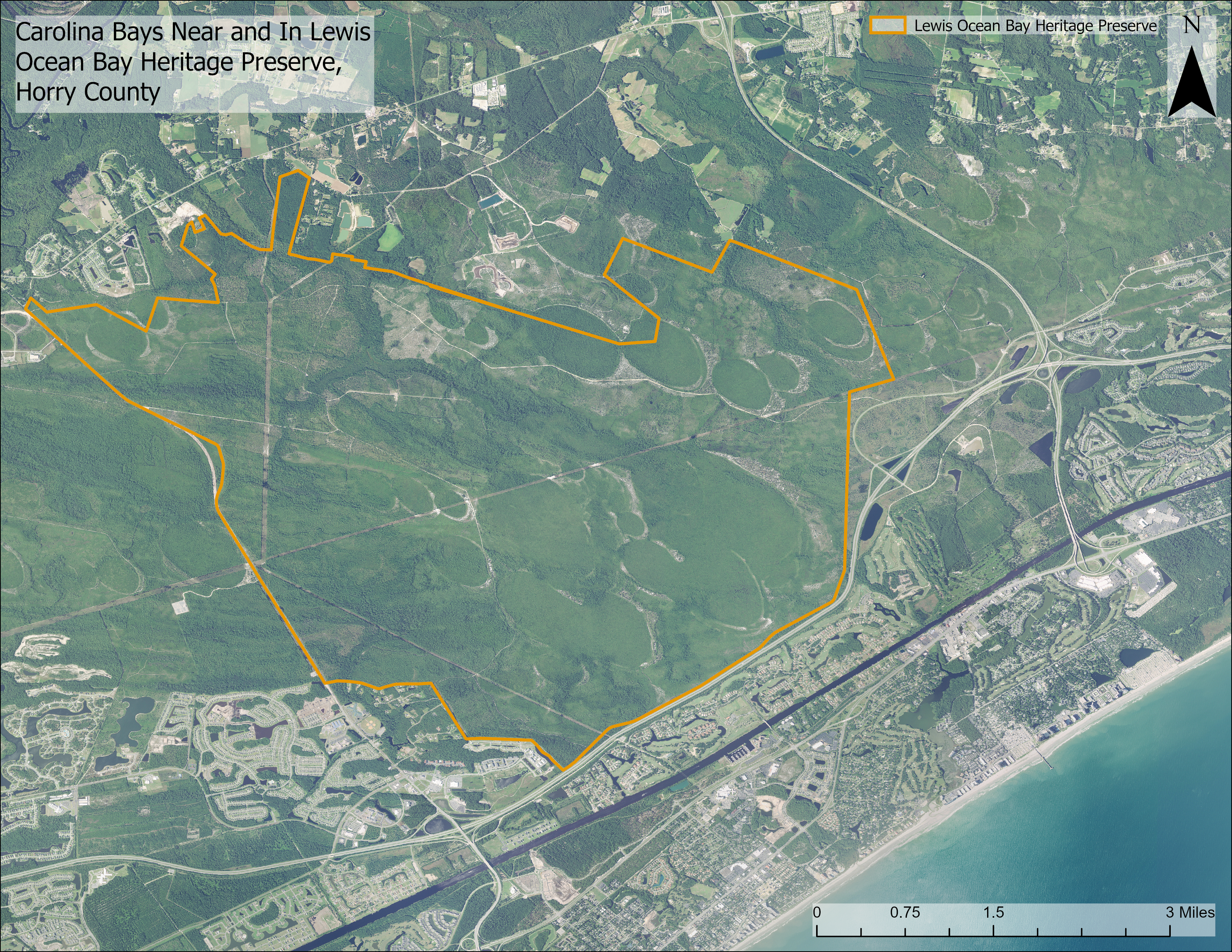
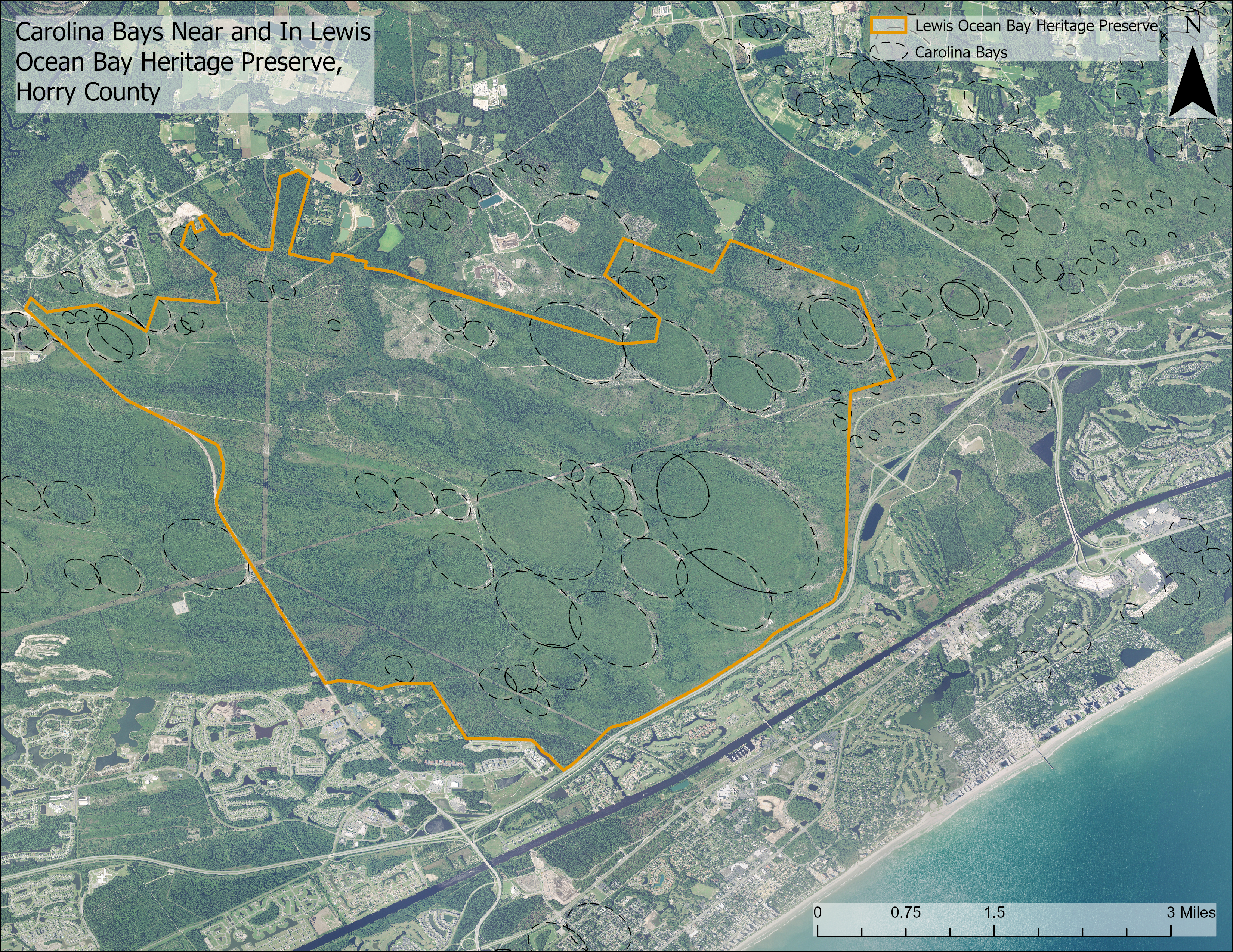
Click on an image below to enlarge and compare. See if you can find the Carolina Bays without the outlines turned on.
Geomorphology and Origin
Carolina bays are geomorphic features developed on the Atlantic Coastal Plain of the United States. The shallow depressions are of various size that are often less than 10 ft (3 m) deep and are oval shaped with their long axis oriented northwest (NW)-to-southeast (SE). They can have sand rims on the northeast (NE) and southeast (SE) sides. Bays range in diameter from tens of feet (a few meters) to several miles (kilometers) across. Their interior basins can be dry or contain swamps, ponds, or lakes. Many bays have been altered by humans; some are partially filled to provide dry, level property for infrastructure construction, and others have been ditched and drained to provide agricultural land.
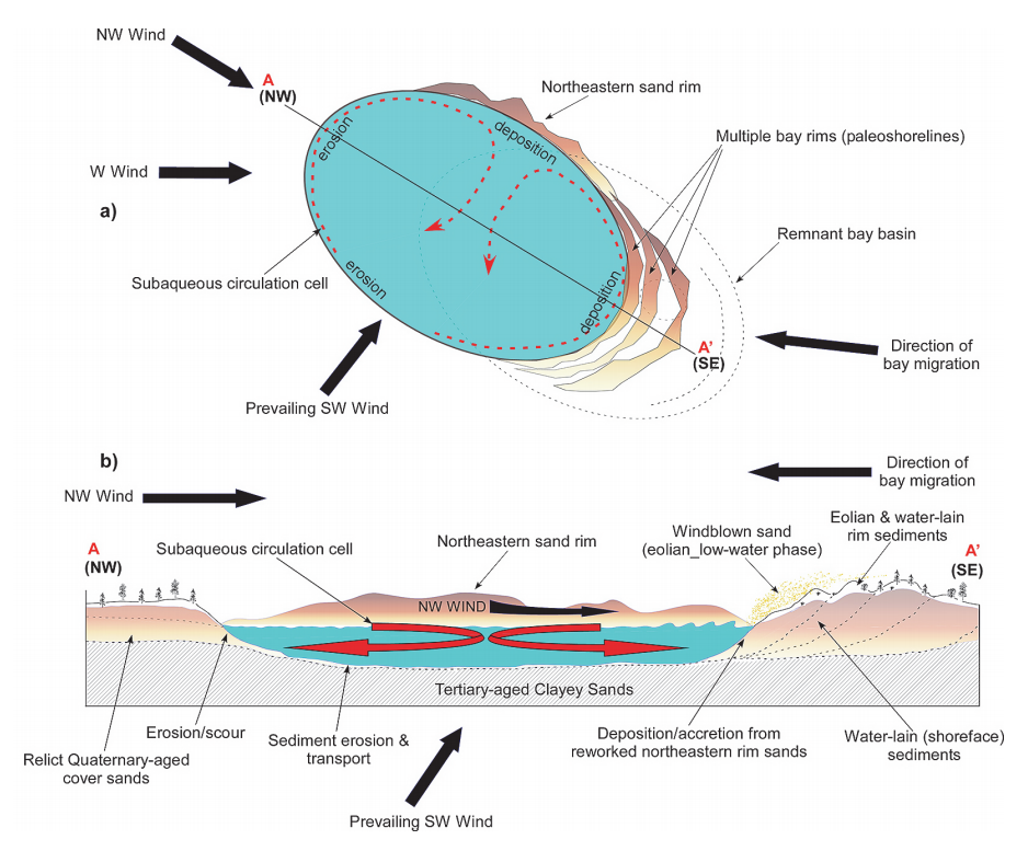
The origin of Carolina bays has remained a point of interest among residents and scientists for years. In 1976, Kaczorowski interpreted bays to have formed as shallow lakes that were pushed into an elliptical shape by prevalent wind patterns, eventually drying out as climate changed. The sandy rims along their southeast and northeast edges are consistent with predicted bimodal wind patterns during the late Pleistocene Epoch (Kaczorowski 1976). The oval shape of the Carolina bays is believed to be formed by the action of strong, southwesterly, late Pleistocene winds on ponded water (Carver and Brook, 1989). The directional winds act as a force on the ponded water creating circulation currents at each end of the bay (Moore et al., 2016). This leads to erosion and scour on the SW and NW sides of the bay and deposition on the NE and SE sides (see figure 6). With time, this wind-water action creates the shallow, NW-SE oriented depressions that we refer to as Carolina bays. Carolina bay sediments have been found to be between 7,500 to 20,000 years old (Wright and Forman 2007). Sand cemented with humate, water-soluble organic substances derived from decayed plant material, forms the impermeable layer at the base of bays, allowing water to rest above the water table (Thom 1970).
Geology
The geology of Carolina bays consists of two main elements: the bay (depression) and the sand rim. The bay is created by fluid scour (wind or water) excavating the existing geological materials. The sand rims are created by sediment transported by littoral (water-lain) and eolian (wind-lain) processes and is sourced from the underlying existing geological deposit. The mineralogy of the sand rims, therefore, is based on the underlying pre-existing deposit and primarily consists of fine- to medium-grained sand, with water-lain muddy sand, sandy mud, and gravelly sand also being common (Moore and others, 2016). After formation, the depressions can fill with other materials. If dry, the bay may be barren and exposed to the wind or contain soils typical of the area. If wet, the bay may contain organic material, silt, and clay from freshwater swamps or lakes (lacustrine).
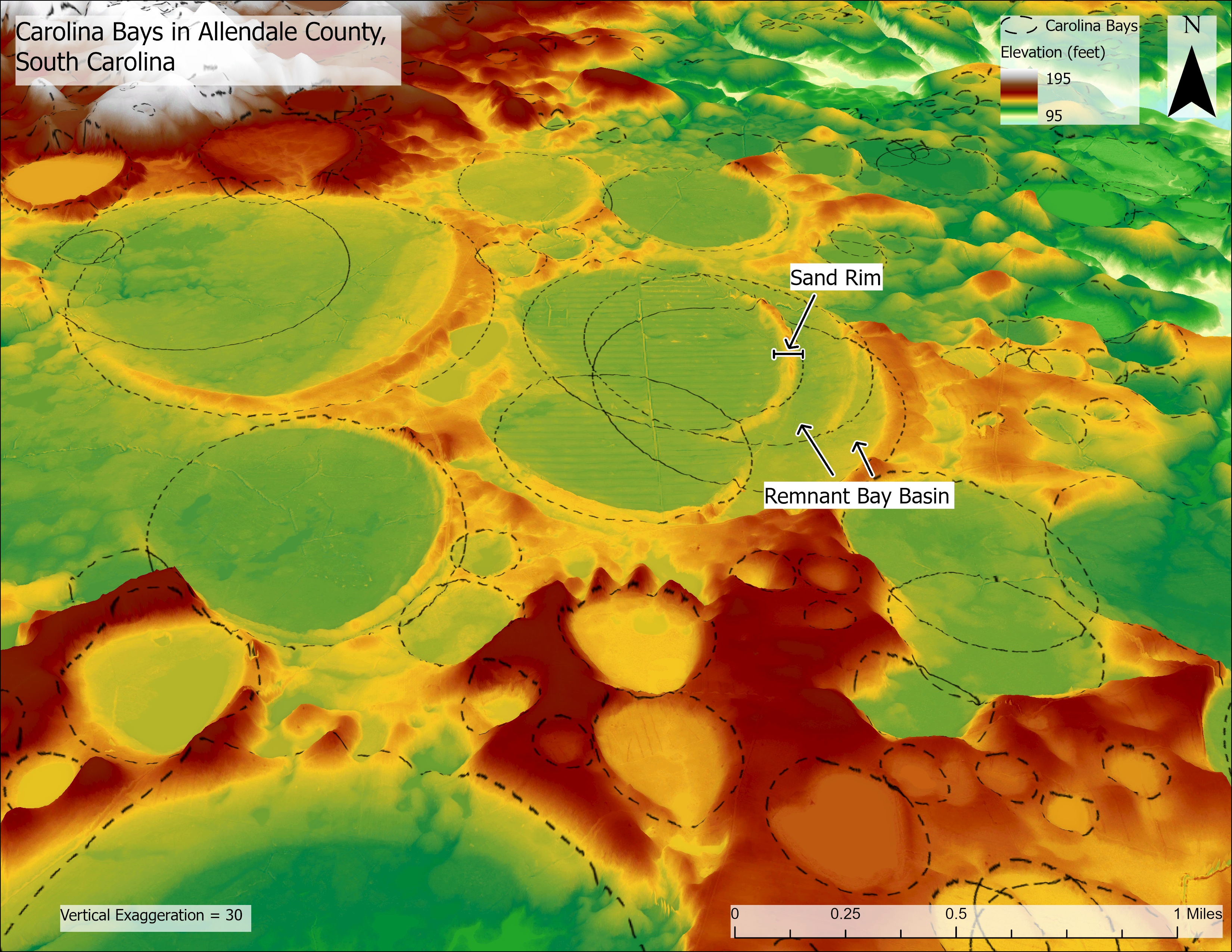
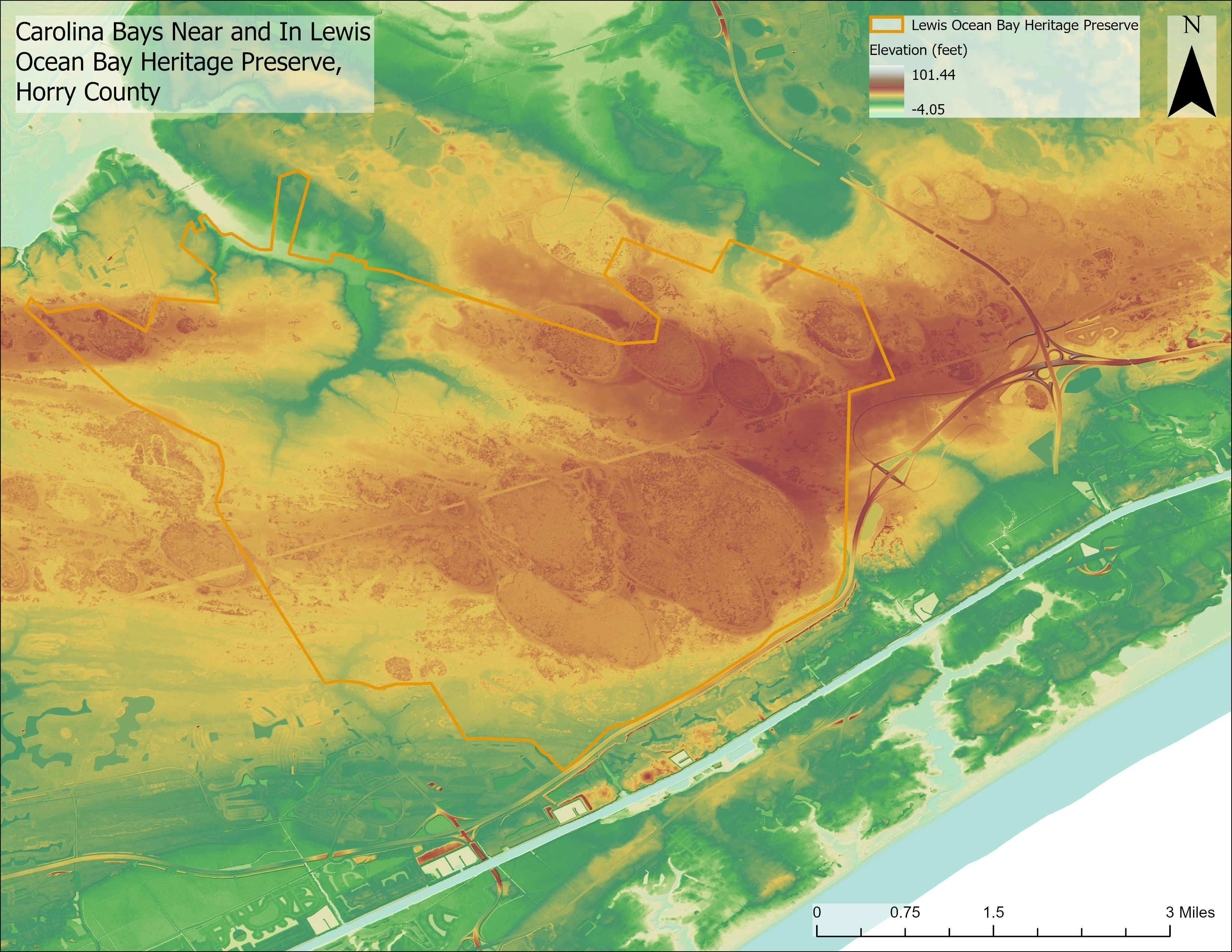
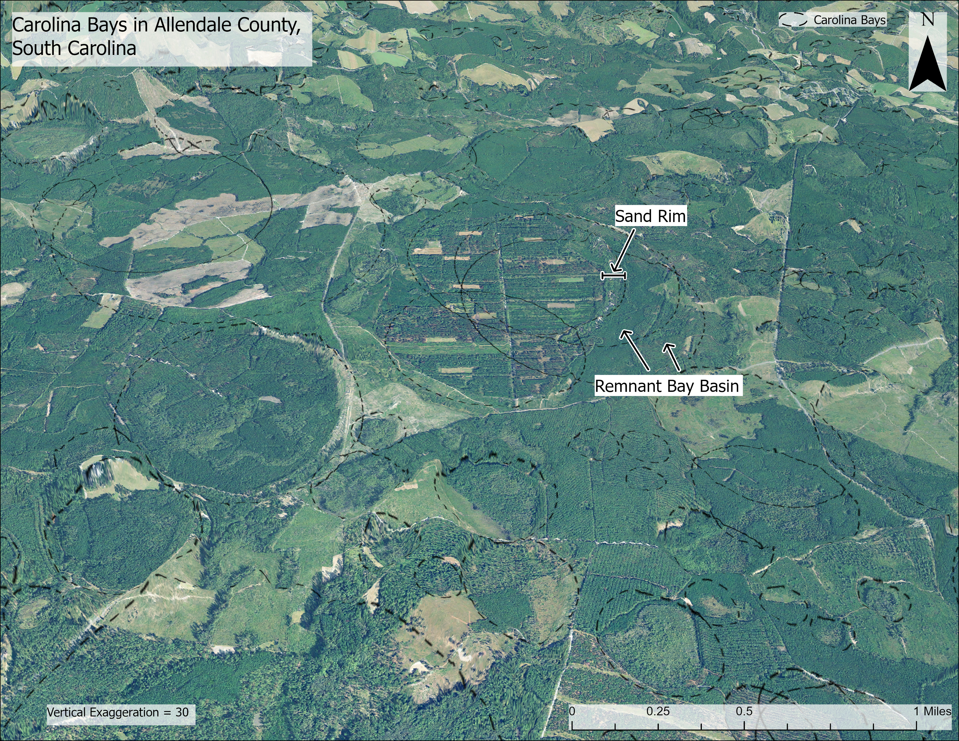
Figure 7. Use the swipe tool above to compare satellite imagery with the digital elevation model of Carolina bays in Allendale County, South Carolina.
As mentioned above, deposition occurs on two sides of the bay (NE and SE) and erosion occurs on the other sides (SW and NW). Over time, this causes the bay to migrate to the NW or WNW direction. This migration pattern allows for the deposition and preservation of rim sediments on the bay’s NE and SE sides. It is common to see younger Carolina bay sand rims overlying older Carolina bay deposits because of bay migration.
References
Bennet, S.H. and Nelson, J.B., 1991. Distribution and Status of Carolina Bays in South Carolina. S.C. Wildlife and Marine Resources Dept., Nongame and Heritage Trust Pub.No. 1. 88p.
Carver, R. E., & Brook, G. A. (1989). Late Pleistocene paleowind directions, Atlantic Coastal Plain, U.S.A. Paleogeography, Paleoclimatology, Paleoecology, 73(3-4), 205-216.
Glenn, L.C., 1895. Some Notes on Darlington (S.C.) 'Bays'. Science, 2: 472 -75.
Hayes, M.O. and Michel, J., 2007. A coast for all seasons: A naturalist's guide to the coast of South Carolina. Pandion Books.
Kaczorowski, R. T., 1976. Origins of the Carolina Bays. University of South Carolina Tech. Rept., No. I I--CRD, Pt. 2:16-36.
Moore CR, Brooks MJ, Mallinson DJ, Parham PR, Ivester AH, Feathers JK (2016). The Quaternary evolution of Herndon Bay, a Carolina Bay on the Coastal Plain of North Carolina (USA): implications for paleoclimate and oriented lake genesis. Southeast Geol 51:145–171
Prouty, W.F., 1952. Carolina Bays and Their Origin. Bull. Geol. Soc. Am. 63:167-224.
Savage, H., Jr., 1982. The Mysterious Carolina Bays. University of South Carolina Press. Columbia, S.C. 121 pp.
Thom, B. G., 1970. Carolina Bays in Horry and Marion Counties, South Carolina. GSA Bulletin, 81 (3): 783-814.
Toomey, M., 1948. Report on the Geology of South Carolina. Columbia S.C.
Wright, E. and Forman, S., 2007. Geologic Studied of Carolina Bays in Northeastern South Carolina (Abstract). Southeastern Section, Geological Society of America-56th Annual Meeting, Savannah, GA, 29-30 March 2007.
