Tropical Storm Cristobal July 18-20, 2008

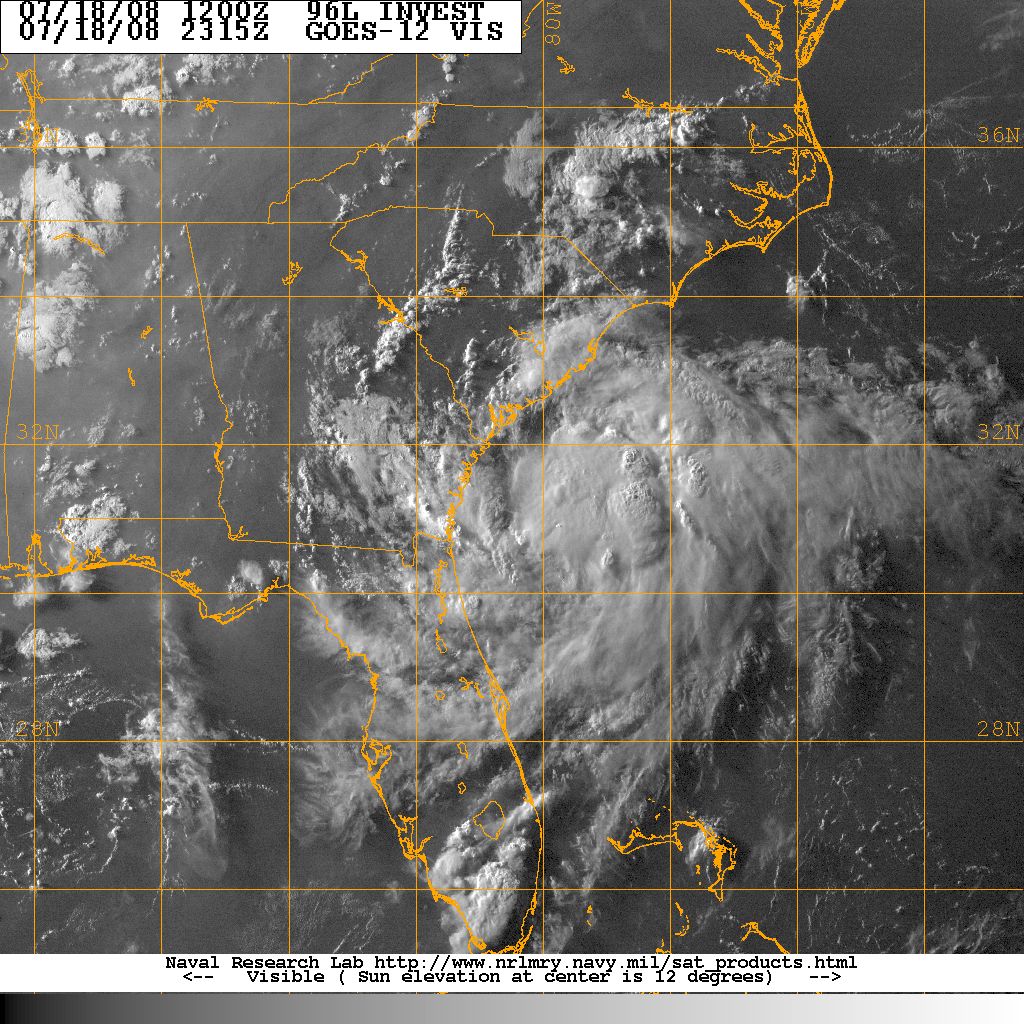
Visible satellite picture of Tropical Depression 3 that intensified and became Tropical Storm Cristobal.
An area of low pressure formed off the southwest coast of Florida and tracked northeast across Florida and emerged over the Atlantic. 65 Miles east of the Georgia-South Carolina border this feature intensified and became a tropical depression at 7 PM 18 July. Tropical Depression 3 tracked slowly northeast continuing to intensify becoming Tropical Storm Cristobal by 7 AM 19 July. Tropical Storm force winds remained east of Cristobal's center of circulation. No tropical storm force winds were observed over land. Cristobal continued to track northeast, weakly brushing the Outer banks of North Carolina. Christobal reached a peak intensity of 55 knots 200 miles southeast of Cape Cod, Massachusetts 22 July.
The National Hurricane Center issued a tropical storm warning for the coast form the South Santee River to the North Carolina-Virginia border 19 July. The warning was canceled the next day. There were no reports of any damage in South Carolina due to Cristobal. The South Carolina State Emenrgency Operations Center was not activated and coastal evacuations were not warranted. Cristobal's only South Carolina effects were coastal rain showers and a few cloudy beach days in July.
Rainfall Amounts(inches) 18-20 July 2008:
Coastal:
Charleston City		0.23
Edisto Island		0.49
Georgetown		0.38
North Myrtle Beach	0.48
Sullivans Island	0.38
Yemassee		0.52
ACKNOWLEDGEMENTS:
Special thanks to the National Oceanic and Atmospheric Administration and its many divisions for the wealth of weather and climate data made available to prepare this report. Specific thanks to:
- National Hurricane Center, Miami, Florida
- Hydrometeorological Prediction Center
- National Weather Service Office, Charleston, South Carolina
- National Weather Service Office, Columbia, South Carolina
- National Weather Service Office, Wilmington, North Carolina
Additional thanks to the Naval Research Laboratory Monterey's Marine Meteorology Division for the well-cataloged library of satellite imagery used for this report.