Tropical Storm Fay, 21-26 August, 2008

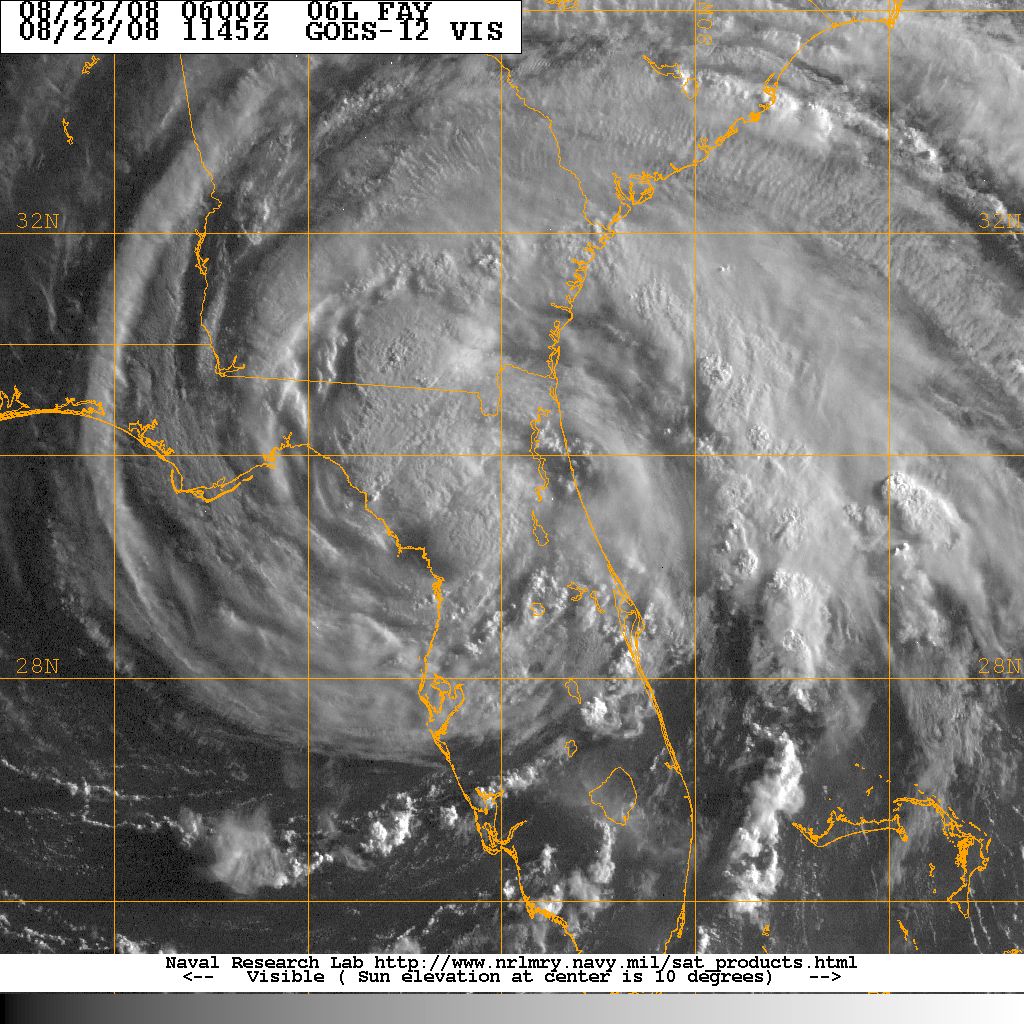
Visible satellite picture of Tropical Storm Fay, 22 August
Tropical Storm Fay began as tropical wave that rolled off the coast of Africa on 6 August and rapidly tracked across the Atlantic towards the Greater Antillles. The initial tropical depression that would become Fay formed on 15 August off the northwest tip of Puerto Rico. The initial depression intensified to become Tropical Storm Fay while over the Dominican Republic. Fay tracked over the Dominican Republic, Haiti, and Cuba. Fay made landfall again near Key West on 18 August, and again between Cape Roman and Everglades City on 19 August. The maximum storm intensity, 60 knots, occurred while Fay was over Lake Okeechobee. After passing over Florida Fay emerged over the Atlantic off the central Florida east coast. Fay tracked north, then turned west and made landfall near Flagler Beach Florida as a weakening tropical storm on 21 August.
After the Flager Beach landfall, Fay tracked across northern Florida emerging over the Gulf of Mexico on 22 August. Fay made a forth and final Florida over the panhandle and weakend to a tropical depression 24 August. The remnants of Fay turned northeast and merged with an old frontal boundary and tracked towards Tennessee 25-27 August where it became an extratropical low. During Fay's long track, the storm made a total of eight landfalls.
Fay spread heavy rains over South Carolina as it passed over northern Florida and on its northeast track towards Tennessee. Fay's outer rainbands also spawned eight tornadoes 26 August that touched down in Chester, Anderson, Pickens, Oconee, Greenville and Fairfield counties. The strongest tornado,an EF2, rumbled from Anderson County into Pickens County with estimated winds near 120 mph. Damage in the affected counties was mainly to trees, powerlines and a few isolated structures. There were no injuries reported due to the tornadic activity.
Rainfall Amounts(inches) 21-26 August 2008:
Coastal:
Charleston City		3.72
Edisto Island		3.34
Folly Beach		3.96
Georgetown		3.57
Hilton Head Island	3.51
North Myrtle Beach	0.28
Sullivans Island	4.26
Yemassee		5.93
ACKNOWLEDGEMENTS:
Special thanks to the National Oceanic and Atmospheric Administration and its many divisions for the wealth of weather and climate data made available to prepare this report. Specific thanks to:
- National Hurricane Center, Miami, Florida
- Hydrometeorological Prediction Center
- National Weather Service Office, Charleston, South Carolina
- National Weather Service Office, Columbia, South Carolina
- National Weather Service Office, Wilmington, North Carolina
Additional thanks to the Naval Research Laboratory Monterey's Marine Meteorology Division for the well-cataloged library of satellite imagery used for this report.