ACE Basin/NERR Studies
Habitat Mapping and Change Program
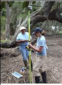
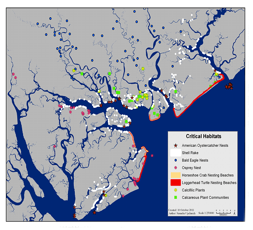
The ACE Basin NERR uses remote sensing imagery and ground-truthing to develop high resolution Geographic Information System (GIS) maps for research sites and other areas of interest within the Reserve. The goal of this program is to understand the relationships between habitat distributions/land use patterns and both anthropogenic ("man-made") and naturally occurring environmental stressors. Maps of specific locations are revised periodically to document significant habitat or land use changes that may have occurred. The ACE Basin Reserve follows a habitat and land cover classification system developed for use by all the NERRs nationwide. Boundary, station location, and GIS datasets may be downloaded from the Central Data Management Office. The ACE Basin NERR Research Sector is also involved in a project is to identify, characterize, and map habitats critical to the survival of species and ecological communities of special concern such as endangered/threatened species and tidal freshwater wetlands.