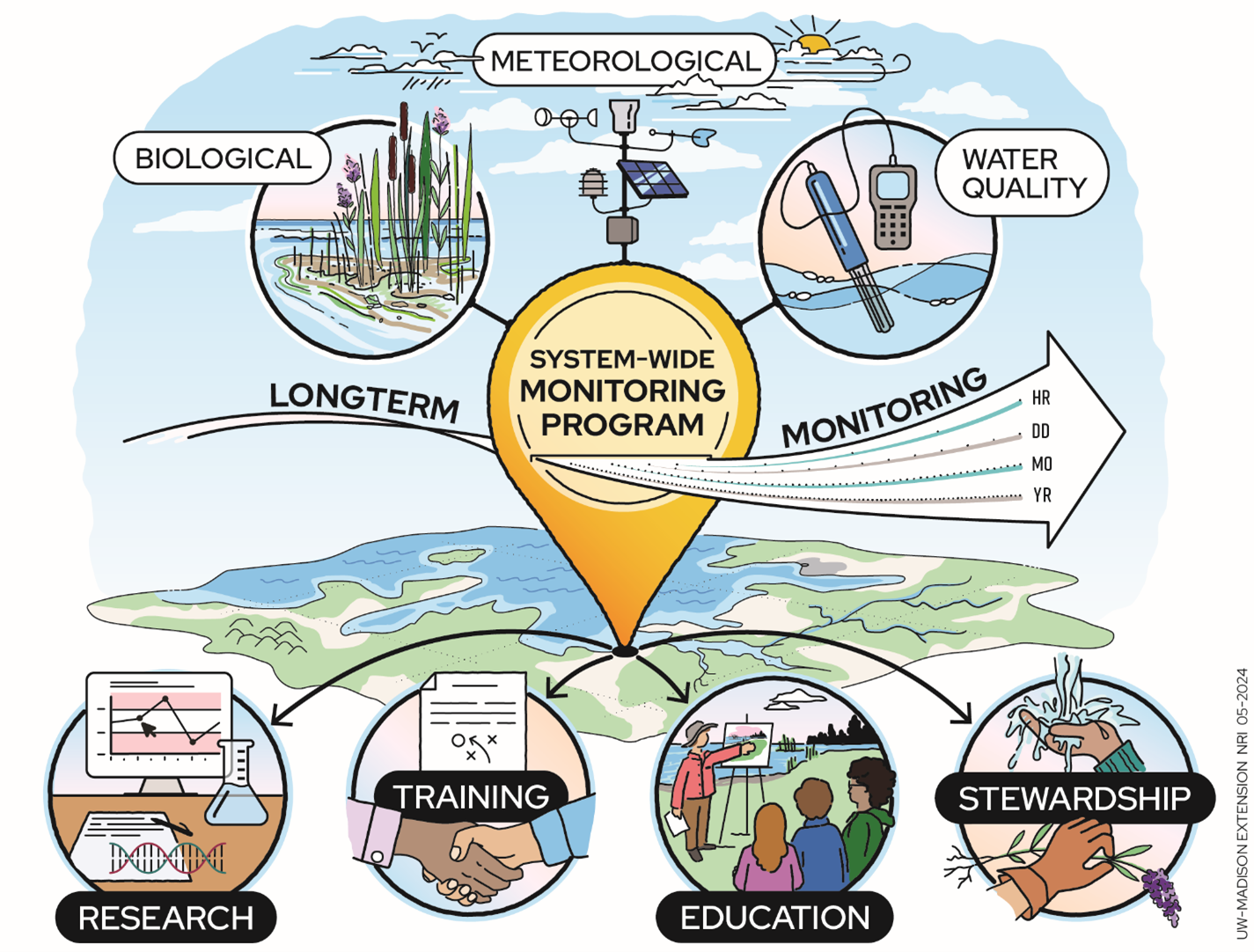
Monitoring
The purpose of the ACE Basin Reserve monitoring program is to document both short-term variability and long-term changes in weather, water quality, plant and animal diversity and sea level rise in the Reserve's waterways – with the goal of informing coastal managers about the dynamics of estuarine ecosystems. Each of our 29 fellow Reserve sites around the country has similar standardized efforts, which we call the System-Wide Monitoring Program (or SWMP, pronounced "swamp").
SWMP started back in 1995, and new types of data have been collected over time. Some of the water quality and weather data is available within an hour of collection, which you can access through the Reserve system's Centralized Data Management Office.
Long-term research and monitoring programs are essential for understanding how ecosystems work over time. Short-term studies are helpful but cannot capture longer cycles or delayed effects that influence ecosystems. The National Estuarine Research Reserve System's System-Wide Monitoring Program shows how long-term studies can meet management needs, improve our understanding of aquatic ecosystems, and benefit communities. Read this article to learn more: Advancing Estuarine Science and Management Through Long‐Term Research and Monitoring in the U.S. National Estuarine Research Reserve System - Reinl - 2025 - Journal of Geophysical Research: Biogeosciences - Wiley Online Library
Weather
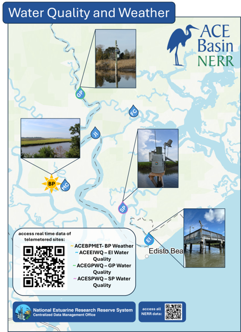
A weather station at the McKenzie Field Station in Bennetts Point monitors conditions every 15 minutes. The weather station measures the following parameters:
- air temperature
- precipitation
- relative humidity
- barometric pressure
- wind speed and direction
- photosynthetically active radiation (PAR)
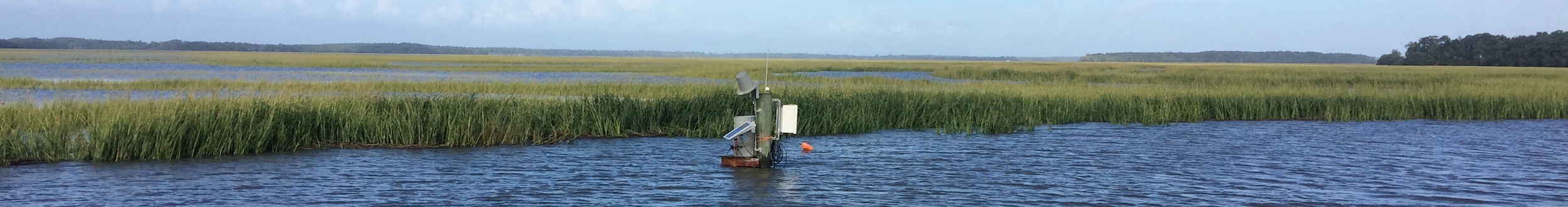
Water Quality
At six sites ranging from brackish water all the way down to marine water, we are able to monitor water quality every 15 minutes. At these sites, we measure:
- water temperature
- specific conductivity
- salinity
- pH
- dissolved oxygen
- turbidity
- depth (tidal cycle)
We also measure nutrient levels in the water, including chlorophyll a, ammonia, nitrate, nitrite, dissolved inorganic nitrogen and orthophosphate. Four of the sites measure nutrient levels once a month, while the levels are monitored every two hours over a complete tidal cycle at the St. Pierre Creek site.
See what the ACE Basin weather and water quality trends are:
Using this data, we have created additional resources like Storm Stories. See how hurricanes and tropical storms have affected weather and water quality within the Reserve: